LUND UNIVERSITY'S FACULTY OF ENGINEERING

Having made a short visit to Jakriborg on the way to Lund, I later arrived at my destination and atlas workshop site. In this post, I have directly copied the text from my analysis, since I believe it explains my thoughts and oppinions of the area quite clearly as it is.


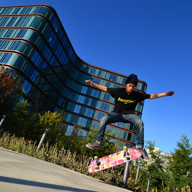
Lund University's Faculty of Engineering is located in the north-western part of the Swedish college town of Lund. It was founded in 1961 and was planned after functionalist principles. The faculty consists of two large building complexes, which are designed to be dense on the vertical plane in order to take up little space of their site and thereby leave space for an open landscape. The open landscape created from the dense building has allowed for the creation of a park area west from the building complex and car-parking areas in the easr. In this case, the complex acts as a buffer zone between the pedestrian paths on the western side of the faculty and the motorized traffic on the eastern side. This buffer effect allos walking and cycling students to move freely and unbothered by the vehicles on the western side, while the motorized vehicles can move with greater ease on the eastern side.


Dense building was a way of planning that was typical for the time. This was done in order to use as little land of a site as possible in order to create large, open natural areas where inhabitants, visitors and workers could take walks and enjoy fresh, clean air. Such urban planning was a reaction to the often highly polluted and unsanitary European old-city areas during the time after the Second World War.


Despite the positive effect of creating harmony in the local traffic and a green belt for pedestrians and cyclists, the consequences of such planning are too great to justify the benefits. This is because of the enormous non-pedestrian, car-parking areas that would end up dominating the landscape of the site as a result of the planning ideologies of the time. The site as a whole illustrates how highly prioritized motorized vehicles were in urban planning during the first decades that followed the Second World War and the immeasurable landscape that was sacrificed in order to maintain this urban planning idealogy.


To make a comparison to the previous post about Helge's Jakriborg, my site is quite the opposite. It is a classic example of rationalistic architecture, where the different functions of the complex are divided in different zones and where motorized vehicles are a great priority compared to pedestrian recreational areas. I believe this should sum things up. It's been interesting to focus intensively on two different sites and their idealogies and create a comparison between the two. With all currently 34 students in my class having made such analysis of different sites throughout the Øresund region, we've taken our first step towards our contribution to the Copenhagen atlas. The 34 different sites are indeed greatly different from one another and paint a rather eye-opening picture of how different urban planning can be both historically and ideologically. Since we are currently still working on the next step of the atlas project, there are yet more updates on the atlas workshop to come in the near future.

- Andy Minchev

JAKRIBORG, SKÅNE

In my previous post, I wrote about our current atlas workshop, in which we were to individually do analysis on different given locations throughout the Øresund region. Since we were four students whose locations were on the Swedish side of the Øresund region, we decided to follow one another to our locations. The first student, Helge, was given the site of Jakriborg, which is located directly between the coastal city of Malmö and the university city of Lund.


Jakriborg was Helge's site, but nevertheless I found it so fascinating, that I simply had to document my experience there. By looking at the picture above, when do you think this town was planned? The 17th century? The 18th perhaps? Wrong again. The Jakriborg residential area was built from the late 1990'ies till 2003! This urban development is a perfect example of the New Urbanism movement, which focuses on urban planning for pedestrians rather than vehicles. The most interesting in this certain project, is that the architects chose to built the entire area as an imitation of a pre-industrial Hansa town. At the arrival from the station, the town area is even surrounded by a fortress wall, built in a way to truely look medieval! Furthermore, the town features a town square, which almost exactly resembles one of a medieval town as well as details such as overhead passages between the town's buildings as seen below.


What troubles me the most is that I can't really decide on my oppinion of this area. On one hand, there is the obvious. Designing an artificial medieval town is not only amusement-park-esque kitsch, but also somewhat of a sin and taboo in modern architecture. I mean, the architects could at least have attempted to make an abstraction of such a town! The whole medieval theme gives the town a rather fake appearance, and this is litterally visible in parts of the buildings where low-cost construction materials have pealed off and reveal isolation boards beneath the "historic" facades! 


On the other hand, if you (as hard at it may be!) ignore the "aesthetics" of the project, I believe that it has certain qualities to it as well. The entire area is planned for pedestrians, with small paths between the houses and small squares in front of the buildings for children to play. The area is a bit of a labyrinth if you will - one that features a fine variety of outdoor spaces, as well as a fine (but perhaps a bit too huge) diversity between the buildings in the area. Walking around the area, one can observe that the locals have even made their surrounding public spaces a bit as their own by having facade plants and other greenery that makes the public spaces more personal. In general, it seems that there is a strong collective spirit among the local citizens and there is a feeling of a common public space with life rather than autonomous private gardens and empty public squares. I believe the picture below captures this feel quite well.


Below is a map of the development site which shows the plan of the entire project (excuse me for the bad quality of the photo). The only part of it which is actually built, is the southern-most area (the slightly isolated rectangle). What happened is that the developers of the site went bankrupt and the project was discontinued, despite great interest among families looking forward to move in to a rather different housing area. 


The sudden discontinuation of the development has clearly left its marks on the area. Below is a picture that illustrates this quite clearly.


To sum things up, Jakriborg is in my oppinion an interesting urban experiment. On one hand, it boasts urban qualities that, quite litterally, invite life to the outdoor area through small squares, paths and green areas, while on the other hand, it recreates an artificial medieval town in a manner that is just too kitschy. Perhaps the aesthetics of the area may be every contemporary architect's nightmare, but among people who have no specific oppinions on the aesthetics and theories of our line of work, I can actually imagine that they probably see this as a pleasant place to live (especially for families with children I suppose). But again, that is only for people who truely can ignore the artificialness of the area and who perhaps accept replacing real cities with amusement park towns.

Further reading:
- Jakriborg Wiki

- Andy Minchev

ATLAS WORKSHOP

As part of our 5th semester projects, we have a lengthy workshop in which we are to contribute to an atlas of Copenhagen. This atlas assignment is done with close collaboration with Dutch architect/graphic designer Joost Grootens, who has great experience with making graphical atlas books on topics such as cities, architecture and social subjects through the use of simple and plain, yet extremely clear infographics. Grootens believes that the atlas is a tool of great worth and one that can often make complex topics and issues more clear through the simple, yet strong use of direct factual statistics. He tries to deliver information on the chosen topics as clearly as possible, or to quote his own words "In such a clear way, that it hurts.". Below is a short film that introduces Grootens and his works.


Our first assignment was to analyze individual real-life locations measuring 300m by 300m within cities in the Øresund Sound area (Greater Copenhagen, Malmö, Lund and Helsingborg). My plot was Lund University's Faculty of Engineering, which is basically a university complex. My analysis of the site will be posted shortly in a separate post.


Our second assignment (the one I'm currently working on) is a group assignment, in which we are given the subject Political Economies. This subject contains themes such as politics and economic factors on urban development, as well as case studies on the process of large scale city planning. While we have argueably been given one of the most complex subjects within the contents of the atlas, it is also perhaps one of the most interesting, especially due to its complexity. Since we have still a lot of work before us on the topic, it is yet too soon to post about this work of ours, but nevertheless, I'll make a post about one of the more lively discussions we've had on one of the sub-topics we've had. We'll have several different workshops that are independant from the atlas during the process, but I'll keep updating about our discussions and ultimately of our final content during the process.

Further reading:

- Andy Minchev

NEW NORDIC

New Nordic is an exhibition currently running at the Louisiana Museum of Modern Art, located in a little coastal town called Humlebæk just north of the capital area of Copenhagen. The museum is well known for its rich exhibitions within modern art, and during the recent years architecture as well. The New Nordic exhibition focuses on Scandinavian architecture, and attempts to define modern nordic architecture through a display of noteable Scandinavian architectural projects, small-scale installations, as well as narratives and discussions from Scandinavian artists, writers and other cultural persons.


With the introduction to our new exchange students, the idea was to explore Scandinavian architecture through both the perspective of our new foreign students, as well as challenging the views and oppinions of the locals. The discussions that played out as a result of the exhibition were indeed quite interesting. The vast majority seemed to agree, that choice of material and relation to nature seemed to be key aspects in Scandinavian design. I fully agree to this, but the interesting thing is that this conclusion is more relevant to the more northern Scandinavian countries, such as Norway, Sweden and Finland. In this case, Denmark has less in common with material choice, where brick and stone are the dominating materials rather than wood, which isn't as efficient a building material due to the Danish climate. Also, building in relation to nature is more relevant in countries such as Sweden and Norway, where especially the latter is rich on mountainious landscapes. 


Furthermore, the discussion expanded towards the contemporary large-scale projects, where Scandinavian welfare politics seemed more relevant than material choice and relation to landscape. It is in this theme of the New Nordic exhibition where Danish architecture makes its place in the contemporary Scandinavian architectural design. While lacking the climates and nature that characterize the other nordic countries, Denmark has embarked in an era where democratic design leads the future. Unlike rapid housing developments of the mid-20th century and the housing boom of the beginning of the 21st century, the architectural process today is rich on public hearings, municipality regulations as well as media coverage. This way of design is of course not solely the work of Danish architecture, but has become almost a must in Scandinavian architecture. There is a common expectation of new large-scale projects, that they contribute to the public and the local life as much as they contribute to the private owner of the building(s). Two examples of such design are Snøhetta's New Norwegian Opera in Oslo, Norway and Lundgaard & Tranberg's SEB Bank HQ in Copenhagen, Denmark. Instead of stealing vast amounts of public space, both these large-scale projects attempt to integrate public life within their private domain, thus giving public space to the citizens, while taking up private space for their needs.


Another part of the exhibition interacted with the idea of giving cities back to the pedestrians rather than motorists. This part of the exhibition was almost directly organized by the Danish city-planner, Jan Gehl, who is currently rather active with his de-motorizing urban strategies. Jan Gehl works in brief with renewing cities through out the world to match the needs of pedestrians and cyclists, rather than prioritizing vehicular traffic. Whether such urban strategies can be generalized as being Nordic is uncertain to me, but they have never-the-less been part of Danish urban-planning for decades. Examples of such planning are the vast amounts of pedestrian streets in Danish cities (most notably perhaps Strøget in Copenhagen) and the great bicycle infrastructure that has been developed in harmony with the existing motorized vehicular infrastructure. 


As you might notice, the subject of New Nordic could be discussed in great lengths and there are perhaps no objective conclusions as to what the exact definition is, due to the personal and subjective nature of the exhibition's theme. Therefore, I shall leave this post at an open end and recommend some reading on the links provided below.

Further reading:

- Andy Minchev

THE SOCIAL CITY

Our 4th semester project consists of a site in a Copenhagen suburb, on which a minor residential area is to be planned. The area of the site is called Hareskov By - a Copenhagen suburb that is located in a large forest area within the borders of Greater Copenhagen (as a matter of fact, the largest forest area within the latter).


Our first step in the project, was to write a program for our vision of the site - How dense should the buildings be? How should the area integrate with its surroundings? Who is going to live there? Due to the lovely natural surroundings of the area, I decided that familys with children (ages ranging from babies to teenagers) should be my primary group for the design of the area. Furthermore, the social life of the residential area was of great priority - This planning was strongly inspired by the theories of the Danish architect, Jan Gehl, who is well known for his urban strategies. With social design in mind, it was also a great priority of mine to integrate the new residential area, with the existing suburban area, in a way that the new and existing citizens can live in harmony, and so the new area contributes to making the existing area better, rather than creating problems or being isolated.


I like to work in areas with contextual surroundings, but on this site, I felt that there was a great lack of such. In order to comprise for the lack of context, I decided to design my houses as abstractions of the surrounding suburban sprawl. With different brick colors and patterns on the exterior, I decided to make my project a sort of village - a city within a city, if you will. Also, in order to make a more interesting and less linear site plan, I distorted the houses so that small spaces a created between the houses, as illustrated below:


Usually I keep writing vast amounts of text explaining the further details of my projects, but due to the great scale of this one, I'll keep it short this time, and let my illustrations speak for themselves.

Ortographics


Renderings


As for the crit of the project, the comments were generally positive. The plan of the residential area (especially the focus on the social structuring and the integration with the existing neighbourhood) received very positive comments. So did the interior planning of the houses (which I haven't been too detailed about in this post). As for the negative commentary, the professors were in doubt about whether the placement of my windows in the houses were right, and also whether the triple differences in both house shapes (there were three different house types) and the three different exterior patterns were a bit too much. All in all, the project received the second highest grade possible, and considering my effort (I often had times in the process where I felt stuck - this especially due to the lack of context in the area), I am all in all satisfied with the result.

That is all for now. With my bachelor year beginning tomorrow, there will be lots more to write about here in the blog. As a matter of fact, we're going to an exhibition in Louisiana Museum of Modern Art as soon as Tuesday (4th September), so a new blog update might be expected as soon as that.

- Andy Minchev

RETURN

Once again, it's been quite a while since I last posted something in here. Since my last post (my trip to Amsterdam), I spent the rest of the pre-summer vacation time on working on my semester project. Once the summer vacation started, I've been busier than expected with both everyday stuff and quite simply enjoying the summer as well. I never could get myself to write in the blog due to the latter, but with my bachelor year starting from tomorrow (litterally), it's time to get the good old blog running with projects, news and what not. Today I'll make a post about my semester project to sum up last semester's work and thus ready the blog for the upcoming content of the new year. So that's it for this post - The semester project one will be written as soon as I post this!

- Andy Minchev